Showing posts with label Lower Salt River Recreation Area. Show all posts

Wednesday, February 8, 2017

An Unrepentant Rebel: Colonel Ridley - Lower Salt River Recreation Area

Among the characters roaming the vicinity of the Lower Salt River Recreation Area, Colonel Alonzo Ridley was one of the most interesting.  As I've discussed previously, Dr. W.W. Jones lived and ranched in the Salt River and Tonto areas in the late 1800's.  The Colonel was a good friend of the Doctor and sometimes kept the Doctor company at the ranch.


Alonzo Ridley immigrated to California from Maine in 1849 seeking his fortune in the gold fields. In the 1850's, he evidently gave up on mining and moved down to the village of Los Angeles where he became an Indian agent on the Tejon Reservation. He later served as under-sheriff in Los Angeles County and it was in Los Angeles where he first met Dr. W. W. Jones.

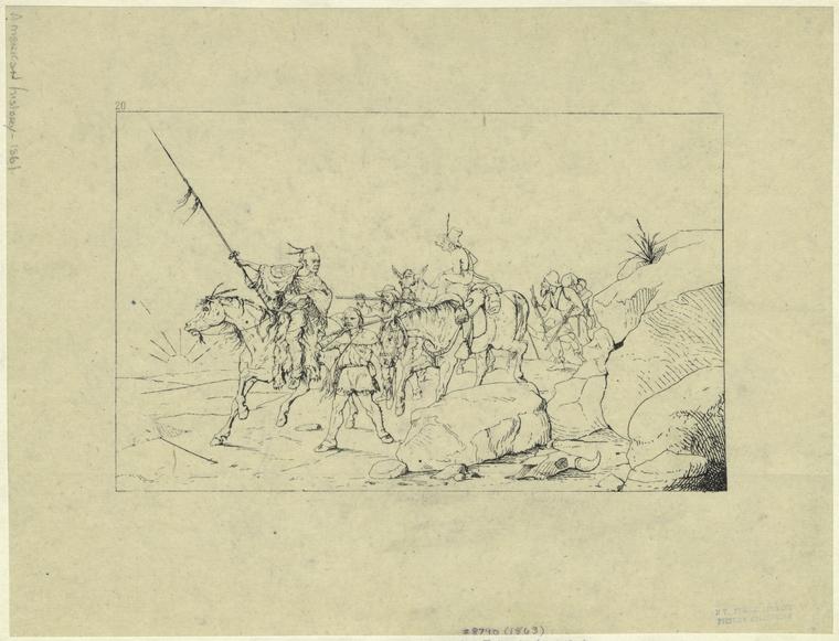
The Colonel's most notable adventure was the escort of General Albert Sidney Johnston from California to Texas.  Albert Sidney Johnston was an experienced soldier, a graduate of West Point and recently commander of the U.S. Army's Department of the Pacific.  Johnston had resigned from the U.S. Army at the beginning of the Civil War and settled as a neutral in Los Angeles.  Eventually, Johnston feared that he would be arrested by Union authorities and so decided to travel to Texas.  Ridley chose the confederate cause while in California where he organized and commanded a militia of like minded men to escort General Johnston to Texas to join the Confederate Army.

Index
Art and Picture Collection, The New York Public Library. "Albert S. Johnston Crossing The Desert To Join The Southern Army." The New York Public Library Digital Collections. 1863. http://digitalcollections.nypl.org/items/510d47e0-f92a-a3d9-e040-e00a18064a99

In 1861, scouts commanded by Captain Ridley led the way across the southern California deserts and across the Colorado River at Yuma.  From the Colorado, they traveled up the Gila River to the Pima villages near present day Phoenix then down the Santa Cruz to Tucson. They continued their trek across Arizona and New Mexico while carefully avoiding Apaches and the Union Army until safely reaching El Paso where the militia was disbanded.

Ridley served as General Johnston's bodyguard at the battle for Shiloh where Johnston was fatally wounded. Afterward, he trained in Texas as an engineer and eventually became a Lieutenant Colonel in the Confederacy but he was captured at Fort Butler in Louisiana in 1863 and was imprisoned until the end of the war.

Index
Art and Picture Collection, The New York Public Library. "Retreat of the confederates from Shiloh." The New York Public Library Digital Collections. 1905. http://digitalcollections.nypl.org/items/510d47e0-f96e-a3d9-e040-e00a18064a99

  After the war he didn't sign the pardon agreeing to surrender but instead emigrated to Mexico and fought on the side of Maximilian in the Mexican Civil War. He lived in Mexico for several years and was employed by a British company responsible for building the Vera Cruz to Mexico City railroad.

In 1877 he returned to the states and met Dr. Jones while Jones was working a gold mill on the Hassayampa River near Wickenburg. He became good friends with Dr. Jones and resided with him many times over the years. In 1885, Dr. Jones and Colonel Ridley were described as entertaining hosts by expedition members traveling down the Salt River. The travelers had reportedly stopped for the night at the Jones ranch just above the Verde River confluence in what is now the Lower Salt River Recreation Area. It's my best guess that the ranch was located near what is now a Forest Service facility on N. Usery Pass Rd.

The Colonel didn't consider himself a citizen of the US. He was a citizen of the Empire of Mexico and referred to himself as such. However, he was required to take the oath of allegiance and become a US citizen in order to be the executor of Dr. Jone's estate in 1896. It says much of their friendship that the old rebel finally took the oath. After settling the estate, he traveled to Havana, Cuba but returned to Arizona after a couple of years. He died in Tempe in 1909 and is buried at Double Butte Cemetery.

Image result for colonel alonzo ridley

References:
Texas Sate Historical Assoc., https://tshaonline.org/handbook/online/articles/fri57
Gene C. Armistead, "California's Confederate Militia: The Los Angeles Mounted Rifles,"
Daily Phoenix Herald, June 5, 1885, "A Daring Expedition".
Arizona Republican, July 16, 1896, pg 5.
Arizona Republican, March 26, 1909

Sunday, January 29, 2017

Ussery Park's Namesake: King Ussery - Salt River Recreation Area


Usery Regional Park is reportedly named after King Ussery a locally famous cowboy, livestock thief and stage robber. He was reportedly a handsome, well liked guy and he must have had some charm to get a mountain range and park named after him. He was born in 1869 and grew up in the Tonto Basin. According to some accounts, he may have also run a few stray cattle on the range near Usery Mountain and the Salt River Recreation Area. He was described in an 1899 newspaper as being "the most notorious, if not the most desperate criminal in Arizona."  No wonder they named a park after him.

In December of 1891, according to the St. Johns Herald, the Globe-Florence (Riverside) stage was stopped by a highwayman in Pinal County who demanded the express box.  He ordered the stage to proceed after being told there was no bullion aboard. The highwayman was identified as King Ussery. Ussery was a small-time cattleman in the Tonto country and according to delinquent tax notices owned a ranch 12 miles up Tonto Creek.

In January 1892, the Globe-Florence stage was again held up in Pinal County and $2,400 worth of bullion was stolen. The highwayman could not be identified but the trail of two horses was followed 50 miles to the corral of Henry Blevins (a friend of Ussery). A bar of of bullion was subsequently recovered from the nearby Salt River.  Blevins was tried by jury and released.

Ussery kept ahead of the law for a long time by hiding in the Tonto country where he grew up.  Eventually, Sheriff J.H. Johnson of Gila County caught Ussery by circling from Globe through Greenback Valley at night to Tonto and staking out King Ussery's mother's home. After capturing his brother, the Sheriff convinced King Ussery to give up. (Side note: In our Air Force orientation class in Lackland AFB back in 1974, the drill sergeant informed us that if we went AWOL he would know where to find us. "When in trouble all boys run back to their mother").  The Arizona Silver Belt also reported on the robbery and added references to Gila County horse theft and a federal charge of mail theft.

Sheriff Thompson and Frank Prothero brought 23 year old King Ussery to Globe for trial. He received a sentence of 7 years at Yuma Territorial Prison.

File:Yuma3-13-04 (16).jpg
Yuma Territorial Prison

He was pardoned in 1894 after appeals from his mother and a review of new evidence that seemed to exonerate him. After his pardon, he evidently changed his ways and shifted to cattle rustling. He received a light sentence in Gila County for the theft and then left the area.

In 1898, Ussery was found not guilty by a jury in the robbery of the Gladiator Mill in Prescott.

In 1899, he shifted to horse stealing. He visited his uncle, a race horse breeder in the Tonto area (John L. Cline), and succeeded in convincing him to let King take a test drive. King then took off for California riding one race horse and leading another. Cline finally recovered one of the horses near the Colorado River but King continued onward with the other. When finally caught in Mammoth, AZ, Ussery was sentenced to 10 more years at Yuma.

Also in 1899, he was arrested near Cave Creek for stealing horses from Jesus Madrial in Yavapai County.

He was also under indictment in Yavapai County for grand larceny.  He was suspected of having robbed a stage several miles southwest of Prescott.  Another man was arrested and jailed for the robbery but Ussery was reported to have helped in his defense and finally admitted to the crime while in prison for the Tonto area horse theft.  The governor became suspicious of the circumstances after learning that the man and Ussery were close friends.  Instead of pardoning him he cut several years off of the man's sentence.

The Arizona Miner (Prescott) reported in July of 1903 that Ussery had sent a hand tooled bridle to Sheriff Roberts with a request for him to sell it to raise some money in anticipation of Ussery's anticipated release from prison.  The bridle was described as being black leather with silver mountings and artistically plaited leather reins. He was finally released around 1903 at the ripe old age of 33.

He must have decided to look for greener pastures after his pardon because it appears that he's buried in King Co., Washington after dying of acute pulmonary edema in 1941. After his pardon, I couldn't find any references to King Ussery, other than his obit.  His death certificate listed his occupation as "miner". Maybe he reformed.

References:
(from Library of Congress, Chronicling America website)
Arizona Republican, Friday January 29, 1892
Arizona Silver Belt, February 27, 1892
St. Johns Herald, Thursday February 4, 1892
S. Johns Herald, Thursday December 8, 1892, pg. 1
Arizona Republican, October 20, 1894, pg. 1
Arizona Republican, Friday December 22, 1899, pg. 5
Arizona Republican, Monday December 25, 1899, pg. 3
Arizona Republican, Sunday November 19, 1899, pg. 3
Arizona Weekly Journal-Miner, November 22, 1899
Arizona Weekly Journal-Miner, January 31, 1900
Arizona Republican, Wednesday June 11, 1902, pg. 1
Arizona Journal-Miner, July 1, 1903

Friday, January 1, 2016

Francisco "Pancho" Monroy - Salt River Recreation Area

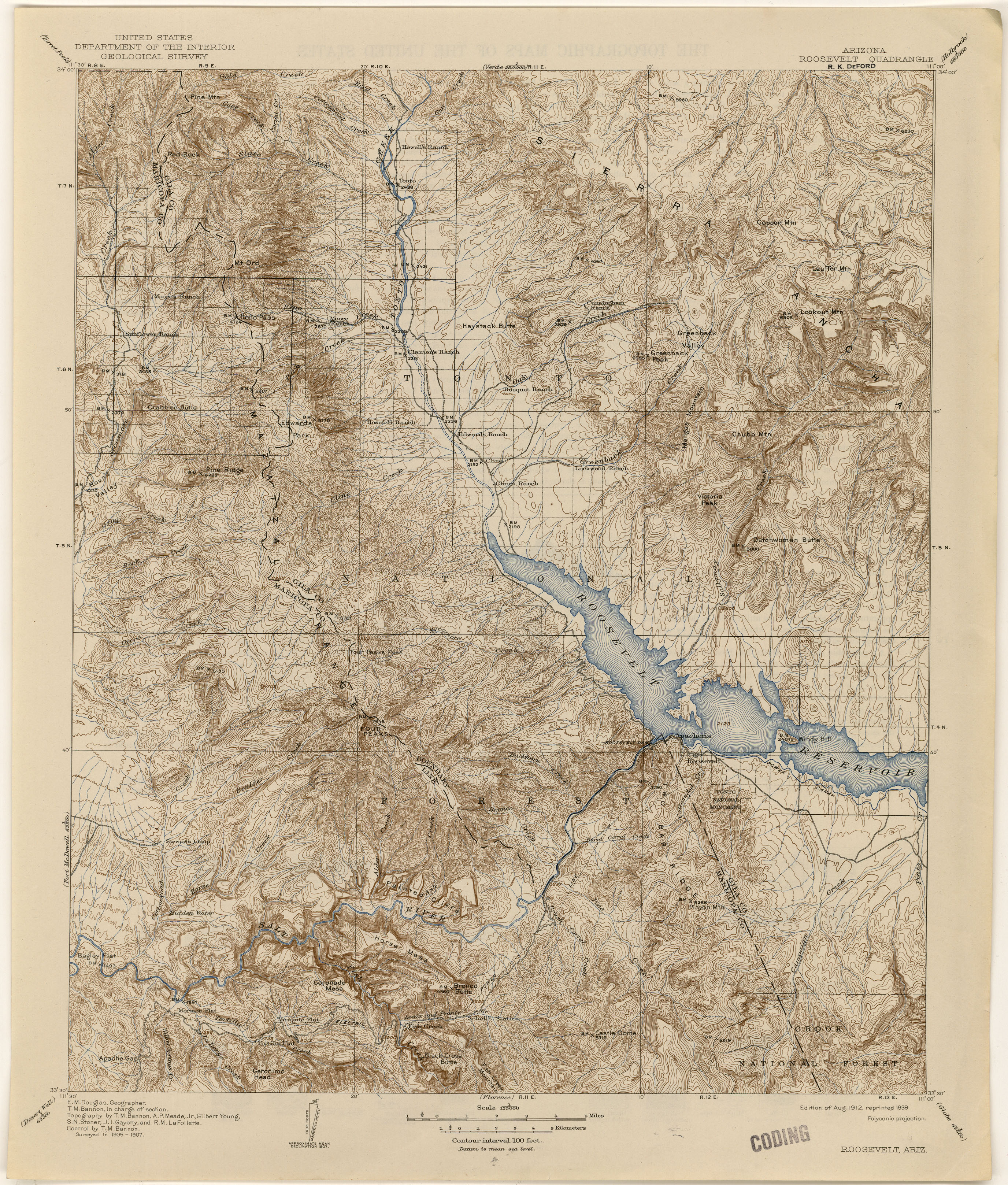
My favorite place for strolling around in the desert is along the Salt River near the junction with the Verde River in the Tonto National Forest.  The area was much busier in the early 20th century when it was still open range and before Tonto National Forest was created.  Old maps show locations of abandoned mines and ranches that are no longer visible on modern maps.  One such site called Monroy's Ranch is shown on a 1904 U.S. Geological Survey map. The ranch is shown west of Blue Point on the south side of the Salt River. The Tonto National Forest Foxtail Administrative Site (located just east of the Usery Rd./Bush Hwy. intersection) is presently at the approximate Monroy Ranch location. Some initial research identified the ranch with Francisco "Pancho" Monroy.


Portion of 1904 USGS Map Showing Monroy Ranch Location

Francisco "Pancho" Monroy is mentioned in Dana Coolidge's book (reference 1), "Arizona Cowboys" as an uncle of Johnny Jones who was the son of Dr. W.W. Jones (an Arizona pioneer and one-time business associate of the Goldwater brothers). He is described in the book as an old-time Mexican cowman originally from Caborca, Sonora. Coolidge had visited the ranch with Johnny Jones prior to publishing his book. Coolidge maintained that visitors were always welcome at Monroy's home.


According to Coolidge, Monroy had been at the ranch for 30 years and had fought off Apaches and lived through droughts and disasters.  However at the time of the author’s visit in 1904, his pastures had been decimated by sheep due to his close proximity to the main sheep crossing on the Salt River. It’s reported that ninety thousand sheep crossed the Salt River near Blue Point and Monroy's Ranch twice a year during the early 1900's.  By 1904, the only stock remaining on the ranch consisted of a few goats.  


The book contains a couple of photos of Monroy.  One of which shows him looking upriver from a high bluff along the Salt River.  If you climb the bluff to the west of the ranch site, the view still looks much the same (see below).


Looking East through Salt River Valley (Monroy Ranch area below bluff)

Reference 1: Arizona Cowboys, Dane Coolidge, University of Arizona Press, Tucson Arizona, 1984.

There is also a photo of Pancho Monroy sitting at his ranch stored in the Arizona State Archive photo collection.

A search for Monroy Ranch in the Chronicling America newspaper search site brings up several Arizona Republican articles mentioning the site over the years 1910 to 1918 (search Monroy Ranch or Francisco Monroy).  Some of these articles relate to local folks camping at the ranch on fishing and hunting trips and others refer to the ranch as a geographical reference point. However, another Arizona Republican article in the August 11, 1918 edition page 10 describes Francisco as being tortured and robbed by heavily armed bandits at his ranch near Blue Point. The article describes five heavily armed men riding up to the ranch and requesting water. When Francisco attempted to get the water they jumped him and tied him up. The bandits suspected that he had hidden money and tortured him with knives trying to get him to tell them the location. Finally, Francisco's wife gave the locations to the bandits and they got off with around $1,500 worth of gold hidden in the house.
Reference link:  http://chroniclingamerica.loc.gov/

According to the book, “Mexicans in Tempe”, Francisco was born in the mid 1880’s and worked as a vaquero on Dr. W.W. Jones’s Blue Point Ranch. It's evident that Dr. Jones ranched in the area considering the location of "Jone's Ford" of the Salt River located just downstream from Monroy's Ranch (see 1904 map).

Monroy is also mentioned in the book "Images of America, Apache Junction and the Superstition Mountains". There is also a photo of him included in the book. Monroy is mentioned in this book and in Lost Dutchman discussion forums as having been a host to Jacob Waltz (Lost Dutchman) as Jacob traveled along the Salt River on prospecting trips. Monroy Ranch is also mentioned as being near the Government Trail river ford that is mentioned in some Lost Dutchman discussions.

Things must have been very interesting during those times.

This summer, when its too hot to for outdoor exploring, I'll explore the library for more material and update this blog.

Adios


Photos of landscape at location of Monroy Ranch.

Clearing near ranch area


Clearing near ranch area

Clearing near ranch area

Road to the river

View over ranch area towards west


Saturday, December 26, 2015

Waymarking - Salt River Recreation Area

I've been continuing my amateur research on the Salt River Recreation Area.  During that research, I found a 1932 General Land Office Survey map of the area on the BLM - General Land Office search site.  The General Land Office (GLO) was the precursor of the Bureau of Land Management and was created to manage public lands in the US.  Part of that responsibility included surveying public lands and administering homesteading applications. During various strolls around the area, I've stumbled upon brass disks mounted on pipes marked "General Land Office Survey 1930" with information indicating that it marks township 2 north (T2N), range 7 east (R7E) and a section corner.  I decided to spend some of my new found retirement time trying to chase down more of the markers.

Portion of 1932 GOL Survey of T2NR7E
In true engineering nerd fashion,  I turned it into big data gathering project that ultimately ended up going from Google Earth to Google Maps and finally to the Waypoints web site.  It turns out that there's a nice topo map overlay available for Google Earth that shows township/range/section lines on the earth view.


Google Earth with Topo Overlay
Using the overlay, I determined approximate coordinates for locations of section corners in the area. Once I had the coordinates, I entered them into Google Maps so I could find survey markers offline.  It's an easy but time consuming process (not really an issue for retirees) to get the coordinates but the challenge is in actually finding the markers.


T2NR7E S8,S9,S16,S17 Corner Marker
The marker in the lower left corner of the above photo took me two tries and several hours to find.  Looking for it involved finding the coordinate using Google Maps then circling up and down ridges and washes until hopefully sighting the marker.  By mistake, I chose to look for this marker first because I knew the area well. After failing to find it the first time, I looked for other markers closer to nearby roads and found two fairly quickly.  The location of those markers allowed me to refine the initial coordinates and eventually find the above marker several hundred feet west of where I first looked.  It was in the bottom of a narrow wash under a bush.

After going to all this trouble finding markers (7 so far), I decided to try and find a good way to share them.  After looking around a bit, I settled on Waymarking.  It's a community of folks interesting in looking for (mostly) interesting things and logging them using GPS.  I've just dipped my toes into it and used it as a place to log sites that I've found and researched while strolling around in the desert.  We'll see how it goes.  I've entered 10 locations, so far.

Adios


Sunday, September 27, 2015

Surprise Venture Haul Road - Salt River Recreation Area

While strolling around on the west side of the Lower Salt River Recreation Area I've stumbled onto several abandoned mine sites over the years.  Recently, I looked up three of them on a Arizona Department of Mines and Mineral Resources (ADMMR) website.  The three described by ADMMR in the Salt River Recreation Area are the Arizona Barite Mine, the Little LaDonna Prospect and the Surprise Venture (Big Red) Mine.  Based on what I'd found while out walking over the years, I thought that there were four old mines in the area.  However, it turns out that the Surprise Venture consisted of multiple sites.  I also found that I was confusing the Little LaDonna with the Surprise Venture for the last decade or so.

(Rev. 12/2015: This has become more confusing since I noticed that the GPS coordinates given by ADMMR match the shaft mine that I've been calling Little LaDonna.  Coordinates given for Little LaDonna are to the NW of the shaft. Also, I've been posting the mine locations at the Waypoints website as Azbarite.)

One of the first sites that I'd looked at turned out to be be the mill site for the Surprise Venture.  The Surprise Venture sites are pretty easy to identify because the mine owners were still proposing improvements as late as 1994.  I haven't been able to find documentation but I'm pretty sure that the recreation area is now closed to mining.  Per the map, there's a mill and a mine shaft on T2N R7E Section 17 and an excavation in Section 9 (Rev. 12/2015: circled area marks coordinates of Surprise Venture per ADMMR. However, the margin notes on the map indicate that it is the location of the Little LaDonna.  I believe that the contradiction is due to inaccuracies in the coordinates.).  The map below is dated 1983 but some of the ADMMR documentation dates back as far as 1962.

(TCS 2/6/17: Warning, the location of the millsite is shown below on the wrong wash.  It is actually located on the next wash system to the east. The millsite and shaft may have been in same general location.  Also, the actual haul road is closer to Bush Hwy.)

Revised 12/2015


Photo of West End of Haul Road Looking West


According to a 1962 Arizona Dept. of Mines and Mineral Resources (ADMMR) report, the owners were extracting granitic rock that contained specks of hematite and scheelite (see possible sample in photo above.  The sample was picked up along the haul road near the mine.).  Scheelite is a tungsten ore and tungsten was the primary commodity of interest.  There's some discussion in the owner docs of gold and silver being trace elements in the ore but I get the feeling that it may be exaggerated. The original claims were filed as Surprise Venture in the 1970's but the land was withdrawn from mineral exploration due to plans for Orme Dam.  The original claim consisted of a single shaft in Section 17 that was being mined as early as 1962.  The plans for Orme Dam were subsequently dropped and claims were refiled as Big Red Mining Co. in the early 1980's.  The new proposal included a mill site and plans to strip mine the ore instead of using a shaft mine.  As of 1985, the only production consisted of a trial run and the sites caretaker was proposing further improvements to get the shutdown facility back in operation.  Much later in 1994, there was a response from the Arizona Department of Environmental Quality to a proposal for processing facility improvements.  There doesn't seem to be any further documentation beyond 1994.  As far as I can tell, the owners and operators have been part-timers.


Surprise Venture Highwall (Section 16)

The site map includes a symbol for a shaft mine near the fork in the haul road in Section 9.  I haven't see any sure signs of it yet but there was a large chunk of concrete near the site of the symbol that seem suspicious. I want to spend some more time looking for the abandoned shaft before I'm sure its at the location below. There's usually a lot more trash and ore in the vicinity of an abandoned mine.


The mill site includes ore dumps, trash piles and signs of what appears to be have been a trailer parking spot. The ores match similar piles at the mine site.

Ore Dump

Ore Dump


Ore Dump

The following photos show some of the trash and building materials at the suspected admin or caretaker sites.

Retaining Wall in Wash

Concrete Blocks (for leveling trailer?)

Buried Trash


Retaining Wall

There seems to have been activity here for 30 years or more.  It would be fun to look back in time to watch what was going on.  I'd guess that a family with children lived on the site for a while based on items in the trash heaps and a strange rock lined path that winds with no apparent logic for several hundred feet through the nearby washes and hills.  The path looks like the work of children with a lot of time on their hands and no internet access.

These sites are easily accessible from the Hawes Trail System or Bush Highway.

It's sure been fun researching this stuff and it sure beats the hell out of working.

Adios


Sunday, September 6, 2015

Sanchez Homestead - Salt River Recreation Area


I went for a short stroll near the Salt River this morning and realized that although Summer has moderated somewhat, its still hot here in the Sonoran Desert.  During the Summer, I found a few old maps of the area and wanted to see if I could find some of the landmarks.  This morning I was looking for a site labeled "Sanchez" on the 1932 Dept of Interior General Land Office map which I assume was a homestead.

1932 Map of T2NR7E (Salt River Recreation Area)


I parked along the road to Coon Bluff in the Salt River Recreation Area and headed NNE.  I couldn't really find any of the old roads with any confidence but I could find the river bluff and then explore along it looking for signs of habitation.  Those signs are pretty sparse after 70 or 80 years.  I finally found a spot on some high ground near a boundary marker to T2NR7E and the intersections of Sections 3 & 4.  The first signs were rusty cans, some barbed wire scattered around the ground and piles of stones that could have been parts of an old foundation.  The boundary marker cinched it though.

Dwelling Outline?

Part of a Worn Horseshoe

Piece of Foundation?

Broken Cast Iron Stove Lid

Signs of Original Road?
Township (2N) and Range (7E) Marker within 100' of Site

I waited a bit late to get out and it was getting pretty toasty so while walking, I kept to the shady groves of mesquite.  The Salt River "wild" horse herd had the same idea.  I tried to avoid them but didn't have much luck.  They looked pretty good considering the long hot summer.  There were at least 2 colts and I didn't see much in the way of ribs showing.  I'm guessing that they were getting plenty to graze in and around the river.  I took a few pictures but the horses may be hard to pick out among the mesquite trees.


I hope to spend a lot more time in the area this fall.  There are a few more homestead sites to try and find.  I'd also like to research the BLM records for earlier sites and maybe grazing permits.  It might also be interesting to try and find out something about the homesteaders (Sanchez, Chavez and Monroy) on the 1932 map.  There are also apiaries (bee hives) shown on the 1932 map but I doubt that there would be any visible sign of them.

Oh well, hot or otherwise, its a beautiful day in Arizona.

Looking East from Coon Bluff Road


Adios

Saturday, February 14, 2015

Dr. W.W. Jones & Family - Salt River Recreation Area

Lately I've been snooping around in a website called Chronicling America set up by the Library of Congress. I ran into the site by following the Google+ site "Phoenix, Arizona Historical Images".  The Google+ site posts lots of interesting historical images and notes.  I decided to do some research on some East Valley pioneers who didn't fit into the typical history book profile.  The following accounts are mostly taken from newspaper articles found in Chronicling America.

Several of the old and existing landmarks around the East Valley are named after folks from the late 1800's and early 1900's.  One of these pioneers was Dr. W.W. Jones.  He was born and educated as a doctor back east in Maryland and then migrated to Los Angeles, California. For several years around 1870, he and a partner operated a freighting business between California and Arizona.  During that period, he married 18 year old Alcaria Montoya in Yuma. They built a home at 1008 E. Buckeye in Phoenix in 1879. His connection to the East Valley is through accounts of his having a ranch near Coon Bluff.  The landmark "Jones Ford" is shown on a 1904 topo map near Coon's Bluff in what is now the Salt River Recreation Area. In addition to Jones Ford, "Monroy's Ranch" is also shown on the map.  It probably belonged to Alcaria's Tio Poncho. Jones is also reported to have operated another ranch near Hidden Water Spring on Cottonwood Creek north of what is now Saguaro Lake (Butcher Jones Beach).

Remnants of ranch life east of Coon Bluff


In addition to ranching, dabbling in politics and occasionally practicing emergency medicine (bullet wounds & such), he was a prospector and mining speculator. He, from time to time, owned shares in several mines from Prescott to Florence including the famous Vulture Mine. In some circles, it's hinted that he may have known Jacob Waltz of the Lost Dutchman Mine legend.  

Dr. Jones is buried in Double Butte Cemetery, Tempe, AZ.

After the Dr's death in 1896, Colonel Alonzo Ridley acted on the behalf of his estate in probate court. The Colonel was a long-time friend of the Dr's.  He was a confederate in the civil war, refused to agree to surrender, emigrated to Mexico, fought on the side of Maximilian in the Mexican Civil War and worked on the Vera Cruz to Mexico City Railroad before returning to Arizona. Colonel Ridley is another character worth exploring.  (I'll write something of the Colonel later).  After the Colonel's return to the states, he lived on the Jones ranch for several years.  Deputy Sheriff G.G. Gonzales (a well known Tempe lawman, at least back then) was initially assigned as guardian of Jone's children until the Dr's son John could take responsibility.  

The son of Dr. Jones, Johnny Jones, ran the Jones ranching business after the Dr.'s death in 1896. According to Dane Coolidge's book "Arizona Cowboys", Johnny worked very hard to collect and sell enough cattle to provide his sisters with an inheritance. Johnny ran cattle in the western foothills of the Four Peaks Range around the Cottonwood Canyon drainage. 

Western Foothills of the Four Peaks Range


Along with other cattlemen in the early 1900's, he had serious issues with sheep traveling through the range. Between the sheep and cattle, the range became badly overgrazed leading to lack of ground cover and increased erosion. The Salt River dams were being built during that time and there was concern by downstream farmers and the government that the erosion could cause increased sediment at the lakes and dams. The overgrazing ultimately led to the formation of the Tonto National Forest. Sadly, Johnny died of the flu while still in his late 30's.

Abandoned Stock Tank and Cattle Pens along Cottonwood Creek


It's been fun researching this stuff.  I'm looking forward to seeing what else I can find.

Adios


Sunday, February 8, 2015

Some History Lessons - Salt River Recreation Area

The wife has traveled back to Columbus Ohio to visit friends and family.  I'm not really alone though, I've had my youngest grand-daughter to keep me company this weekend.  She's stayed both nights (have I become so old that I require a babysitter?).  Although she mostly has her nose in the Ipad, it's nice to have company for dinner.  She and I have different tastes regarding meals so we compromised and had Taco Bell Friday night and KFC last night.  I'll probably cook breakfast this morning (assuming she gets up before lunch).

I recently read Dane Coolidge's book "Arizona Cowboys".  It was originally published in 1938.  He was a photographer who traveled the West recording flora, fauna and frontier life.  "Arizona Cowboys" is a narrative of his times spent with cowboys and cattlemen in the Arizona of the early 1900's.  It gives a good description of the times and certainly redefines some of the Hollywood notions of rodeo and sheep-cattle conflicts.  The book also explains how overgrazing by sheep and cattle were destroying the grasslands around the Tonto Basin and Salt River watershed leading to erosion problems that could threaten the water projects being developed.  The Tonto National Forest was a direct result.


It turns out that a rodeo was work not sport in the late 1800's and early 1900's.  It was a time when cattle owners got together to gather up their stock.  Not all cattlemen were ranchers, some were just individuals who branded a few head of stock and turned them loose on the open range.  A rodeo was arranged so that all owners could participate in the roundup and be available to identify their branded stock and to claim any new calves belonging to their stock.  By the way, there's still at least one bovine roaming around near Coon Bluff.  I've seen it's tracks and spoor but haven't been around early enough to see it.  By the time I get out, it's probably laying in cover chewing its cud.

The proof may be clearer to those of us who have spent time cleaning up after cattle and also recognize the split hoof print.

One series of the Coolidge stories were recorded in the area along Cottonwood Creek north of what is now Saguaro Lake (the lake appeared 1930).  There were several ranches between Mesa and the Tonto Basin (Roosevelt Lake now).  I believe that the largest was probably the Stewart Ranch (under the lake now at Butcher Jones Beach) but Dr. W.W. Jones and his brother-in-law Francisco "Pancho" Monroy also had ranches in the area.  The Monroy Ranch is shown on 1904 topo maps at a bend in the River near the present day Usery Rd. intersection. I'm not sure of the details yet but Dr. Jones is said to have had a couple places along the river.  There's a Jone's Ford (river crossing, not car showroom) shown near the Verde River, Jones Canyon and Butcher Jones Beach near Saguaro Lake and a Jone's Creek near Cottonwood Creek, these could be clues the locations of Dr' Jone's places.  There are several signs of ranching near this area. The most extensive are near Jone's Ford north of the Forest Service Goldfield admin site.


The Monroy Ranch is shown on the topos as being Southeast of Jone's Ford and it's ranch house is described in "Results_of_Spirit_Leveling_in_Arizona_1899-1909" as being 600' NE of BM1382 PHNX.  I haven't been able to find the benchmark or any sign of a ranch house. Here's what the nearby area looks like.  It's mostly mesquite bosque with a few scattered clearings.


I drove out to Cottonwood Creek via FR104 to see what was left of Stewart's Camp (1907 Roosevelt topo).  It was a locale described in a rodeo story in the Coolidge book.  I took the Beeline Highway east to the turnoff to Four Peaks then drove on to the intersection with FR401.  On the way to Stewart's Camp, not too far along FR401, there's a cattleguard in the roadway and soon afterward a stockyard with an old scales.

Stockyard with scales in background

Stockyards with Superstition Mtn in background


Surprisingly, FR401 was a good road all the way to Cottonwood Creek.  It was, of course, dirt but there were very few potholes and not much washboarding.  There's still a lot remaining of the old stock camp.  The most evident are corrals, a large water tank and some scattered stone/cement foundations.


Sadly, the area hasn't been treated very gently.  Folks had used the rear of the water tank for a toilet and there was graffiti sprayed all over it.  There also appeared to be someone homesteading in their mini-van.  Driving down here I was reminded why I don't do much hiking near Forest Service roads.  As usual, there was a lot of target shooting going on.  Good or bad, it's pretty disconcerting for hikers.

I've been doing a bit of research on some characters of the era and will try and post stuff as I get more info.

Adios